 MWE Correspondent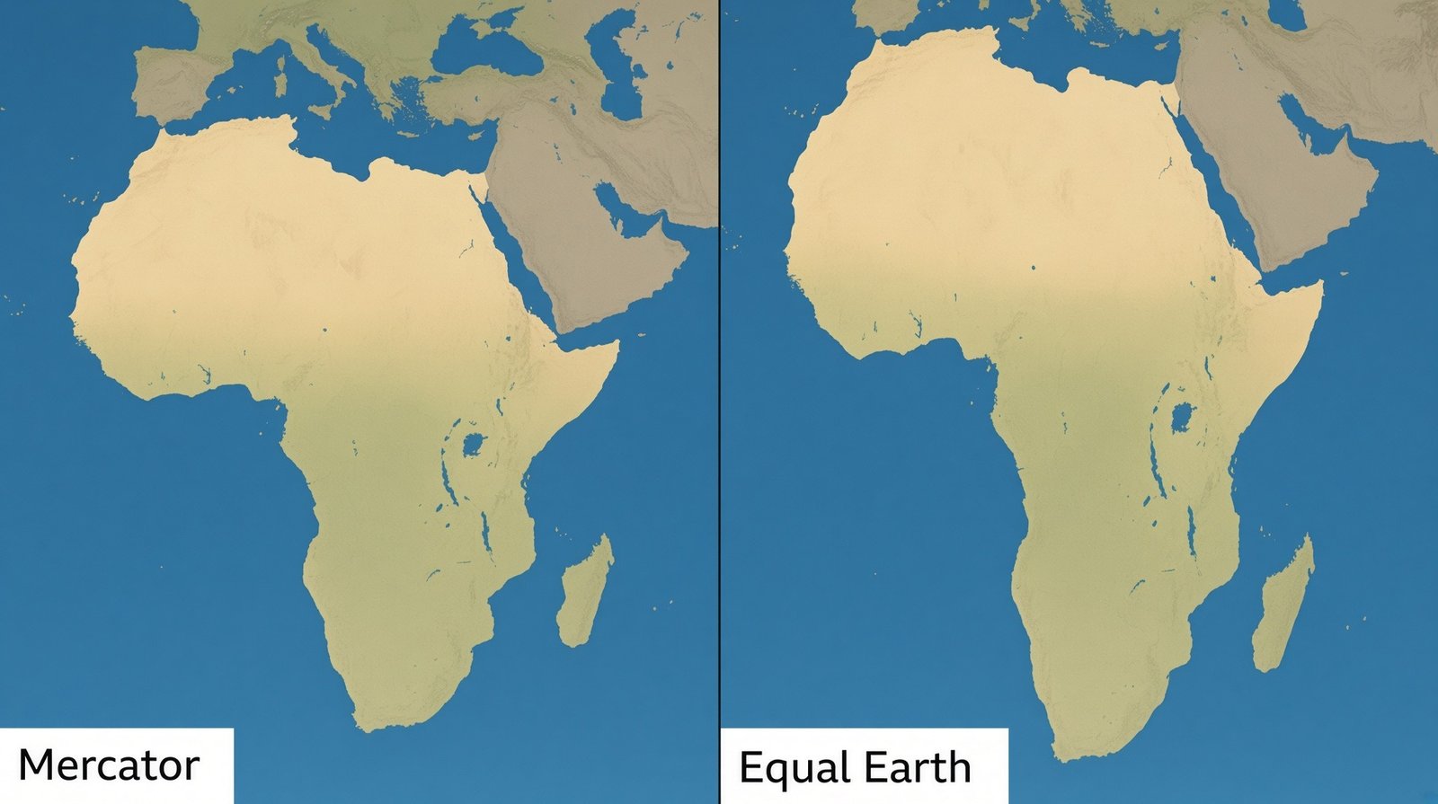
The United Nations General Assembly has adopted a resolution encouraging the use of world maps that represent the relative size of continents more accurately, particularly Africa.
The resolution, led by Togo and supported by African countries, was adopted on September 4, 2026, with 164 countries voting in favour. The United States was the only country to vote against the resolution.
The resolution promotes the use of the Equal Earth projection, a map projection designed to represent the relative areas of regions across the world more proportionally to their actual size.
The move seeks to encourage alternatives to the widely used Mercator projection, developed by Flemish cartographer Gerardus Mercator in 1569. While the Mercator projection has historically been valuable for navigation, it significantly enlarges the apparent size of areas closer to the poles while reducing the visual representation of regions near the Equator, including much of Africa.
Also Read: TMA Urged to Strengthen Weather Monitoring and Early Warning Systems
One commonly cited example is Greenland, which can appear comparable in size to Africa on a Mercator map despite Africa being vastly larger in actual land area.
Critics of the Mercator projection argue that such distortions can influence how people perceive the geographical size and relative importance of different regions, particularly Africa.
The adoption of the resolution has therefore been welcomed as an effort to promote greater geographical accuracy and encourage more balanced visual representations of the world’s continents.
However, the UN resolution is not legally binding and does not prohibit the continued use of the Mercator projection.
Instead, it encourages governments, educational institutions and technology companies to consider map projections that provide a more accurate representation of the relative size of land areas.
The development comes amid wider discussions about how maps shape people’s understanding of geography and how modern mapping tools can provide representations that better reflect the actual size of countries and continents.
For Africa, supporters say the move could help address long-standing misconceptions created by conventional world maps and provide students and the wider public with a more accurate understanding of the continent’s geographical scale.